DPLUS083 - SOIL MAP & ONLINE DATABASE AS CLIMATE CHANGE MITIGATION TOOLS

The Falkland Islands prioritised climate change mitigation action plan considers soil erosion, soil carbon content vulnerability and climate change assessments at policy level as high to medium priorities. To support these mitigation policies a baseline survey of soils, peatlands and erosion extent/risk will be undertaken and the results conveyed on an online data system to assist policy makers, conservation officers and land managers in deciding which actions are needed for long term mitigation measures against climate change effects.

Background

Soil erosion due to dry and windy conditions, past uncontrolled grazing and sporadic fires is a widespread, unevenly distributed and dynamic process on the Falklands. Climate change predictions show a rise in temperature and an increased soil moisture deficit through increased seasonal evapotranspiration which could alter soil organic matter content with knock-on effects on soil biological, physical and chemical properties. This would further increase the risk of erosion and some of the shallow soils with high organic matter could change from carbon sinks to carbon sources. The Falklands have neither a soil map nor an accurate understanding of the extent and the state of the peatlands.

This project will address the lack of evidence through undertaking a baseline survey of soils, peatlands and erosion extent/risk. It will provide an online data system for viewing the maps, interpreting the chemical/microbiological aspects of the soils and will assist policy makers, conservationists and land managers in minimising erosion risk, greenhouse gas emissions and maximising conservation of peatlands.

The amendment of agricultural land improvement policy and the conservation of the carbon store in fragile soils are medium/high priorities of the Islands’ climate change mitigation action plan and align with the FI Biodiversity Framework.

Project Objectives

Priority issues

Developing approaches to deal with the effects of climate change, including renewable energy schemes

Overall in the Falklands, policy makers, habitat restoration officers, landowners and agricultural advisors need science-based information to underpin cost-effective strategies for erosion limitation and climate change resilience. This project aims at filling the knowledge gap about the national soils which show structure, properties and responses to environmental change remarkably different from those that are, often incorrectly, compared with. The project will provide quantitative information on the extent and rate of erosion, inform on the causing factors and support the development of effective mitigation plans.

Developing data systems on biodiversity (and human activities affecting biodiversity) to help develop policies and management plans (including baseline survey and subsequent monitoring)

The data will be shared and made publicly accessible through a system infrastructure built on a spatial database and GIS/webGIS services. The data will be obtained from the soil campaign, the remote sensing analyses and the laboratory tests. Overall the data generated will help quantifying national carbon stocks (believed significant if compared to UK’s territorial area), assess the risk of carbon emission in case of peatland degradation and overall allow the assessment and economic evaluation of soil as natural capital.

Project Manager

DR STEFANIE (STEFFI) CARTER

Steffi obtained a BSc (Hons) degree in Countryside Conservation from Aberystwyth University as well as an MSc in Managing the Environment. Her studies focussed on habitat restoration and included soil survey and freshwater habitat projects. In 2018 she also gained a PhD from Aberystwyth University which focussed on the impact of different drain blocking techniques on gas flux, vegetation and invertebrates in an upland blanket peat. Steffi’s passion for the natural environment also enabled her to acquire a wider range of ecological knowledge. She arrived on the Falkland Islands and joined SAERI in August 2018 to lead the two-year Darwin Plus Soil Mapping project, which produced a range of soil maps for the Falkland Islands. Steffi is now managing the two-year Darwin Plus Wetlands Project, which aims to create a baseline for wetland habitats across the Falklands and at the end will inform local government on long-term monitoring strategies.

Technical excellence

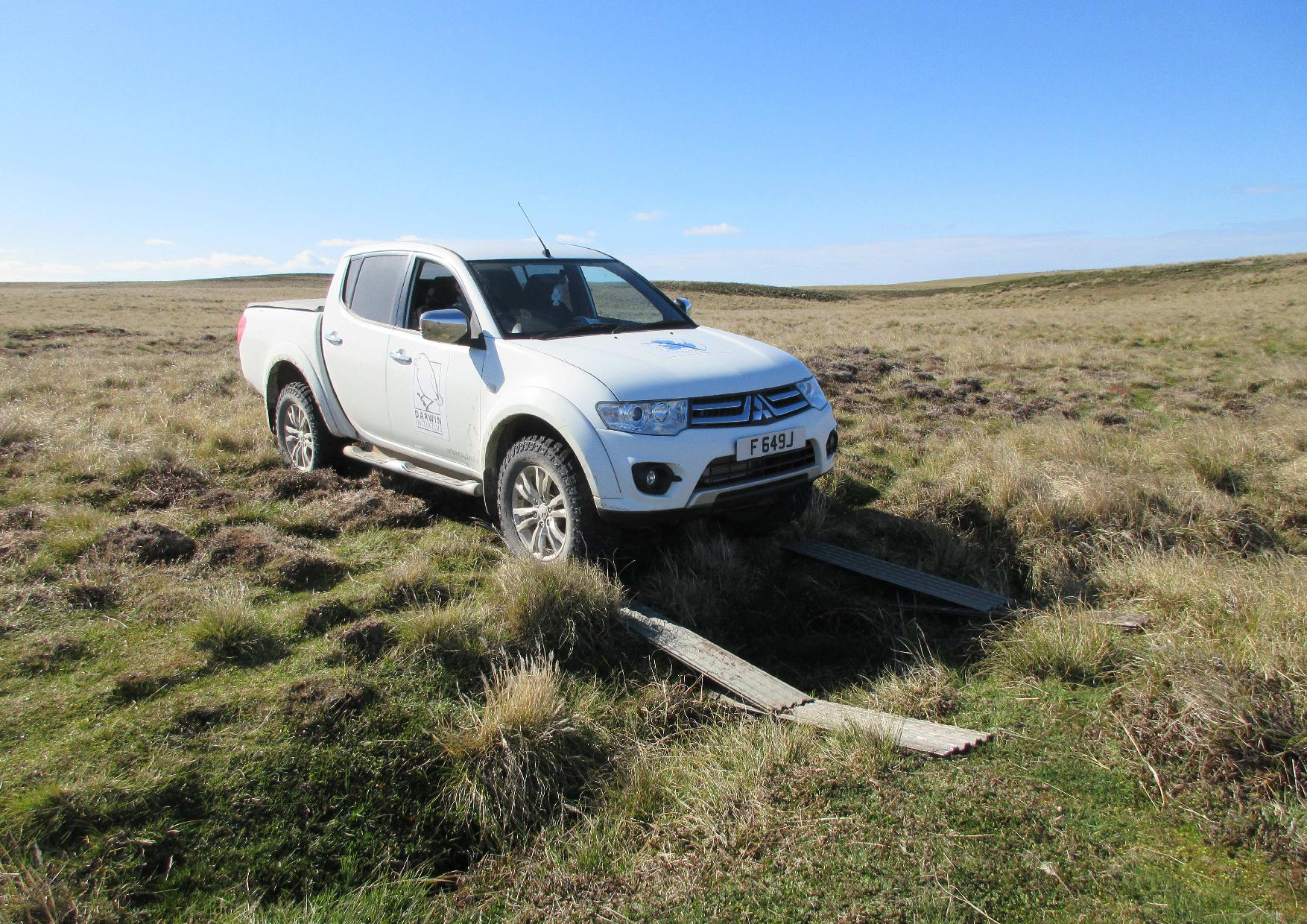
Latest Earth Observation analytical techniques will be applied during the desk study and accurate descriptions of soil properties will be ensured during the fieldwork. To generate the distribution map of soil, peatlands and erosion (extent and risk), the project will require thorough data collection, remote sensing analyses and database development which will be carried out by local and overseas experts who have detailed knowledge of, and a track record of delivery in the Falklands.

The information and monitoring tool will be user-friendly and purpose-built to meet the needs of the stakeholders through a feedback loop. The local data management and GIS specialist has a proven record of functional tools for data discovery, dissemination and accessibility.

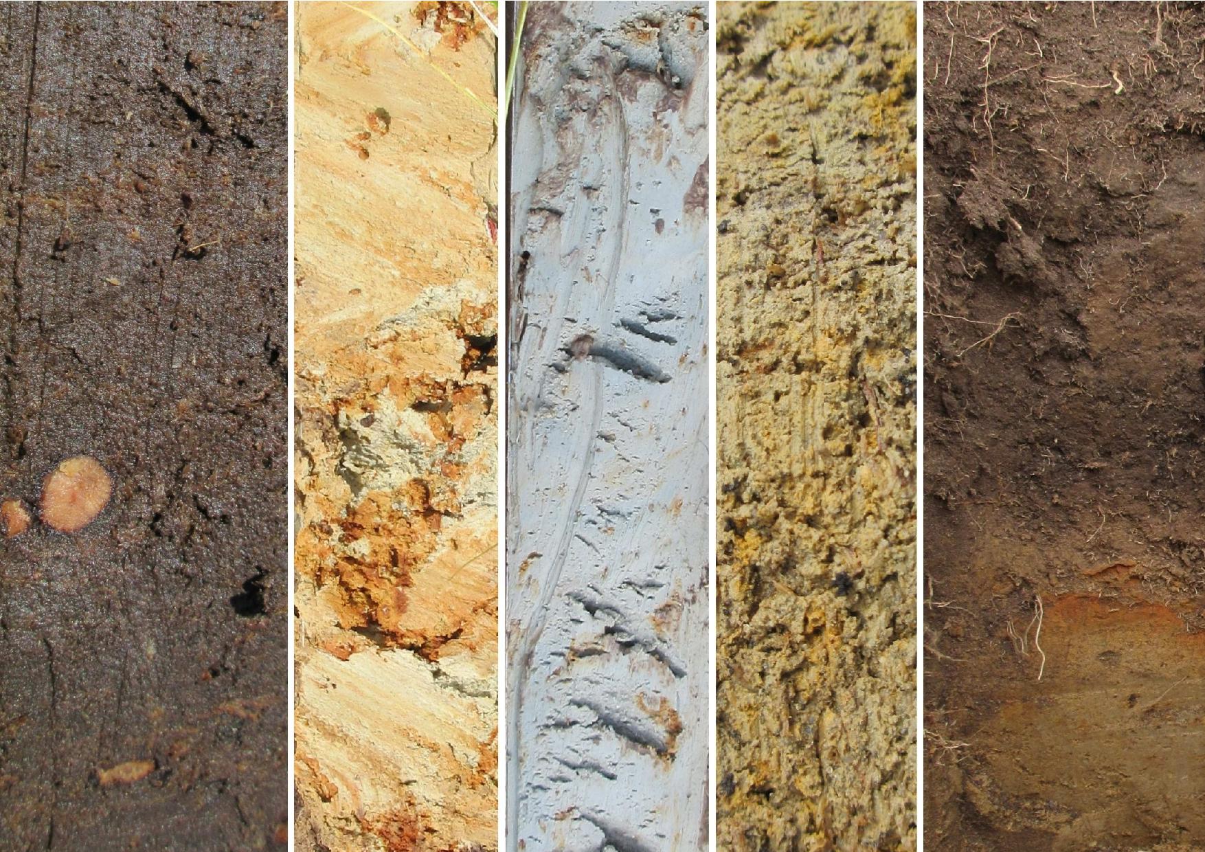
Chemical laboratory analyses for soil organic carbon, pH, bulk density, Al, Mg, N and high throughput DNA sequencing for microorganisms identification will be carried out in the Falklands and overseas using established standard protocols.

Impact in the OT(s)

The project will deliver an online data system which will be an innovative and unique decision tool based on the integration of agriculture and restoration priorities for sustainable farming, reducing erosion, assessing GHG emissions from peatlands and mitigating climate change effects across the Falklands. Information on soil physical, chemical and biological properties, spatial distribution of peatlands and erosion risks will be delivered from local farm regions to national level.

The local Habitat Restoration and Agricultural officers will liaise with the scientists and the landowners facilitating knowledge exchange and collaborations. The group of selected farmers will provide the nucleus for a knowledge transfer campaign across the islands and enable local government to best target its resources. Fieldwork will be open and landowners can join and follow the progress of the soil campaign though the various stages of analysis and contribution to the risk map.

As well as being of fundamental importance to the Falklands, this will be a unique model which will be applicable in small island states and could readily be implemented across other OTs.

PROJECT FUNDING AND PARTNERS

The project is funded by the Darwin Initiative through the UK Government

Darwin Initiative’s project DPLUS083

Collaborating organisations:

FALKLAND ISLANDS OFFICE:
PO Box 609, Stanley Cottage North
Ross Road, Falkland Islands
Stanley, FIQQ 1ZZ
Falkland Islands: +500 27374
UK Office: +44 (0)20 3745 1731
© Copyright 2022 - SAERI
Proudly designed with Oxygen, the world's best visual website design software
envelopephone-handsetmap-markercheckmark-circle linkedin facebook pinterest youtube rss twitter instagram facebook-blank rss-blank linkedin-blank pinterest youtube twitter instagram