DPL00047: Increasing environmental monitoring capacity on FI: a Thermal Imaging UAV

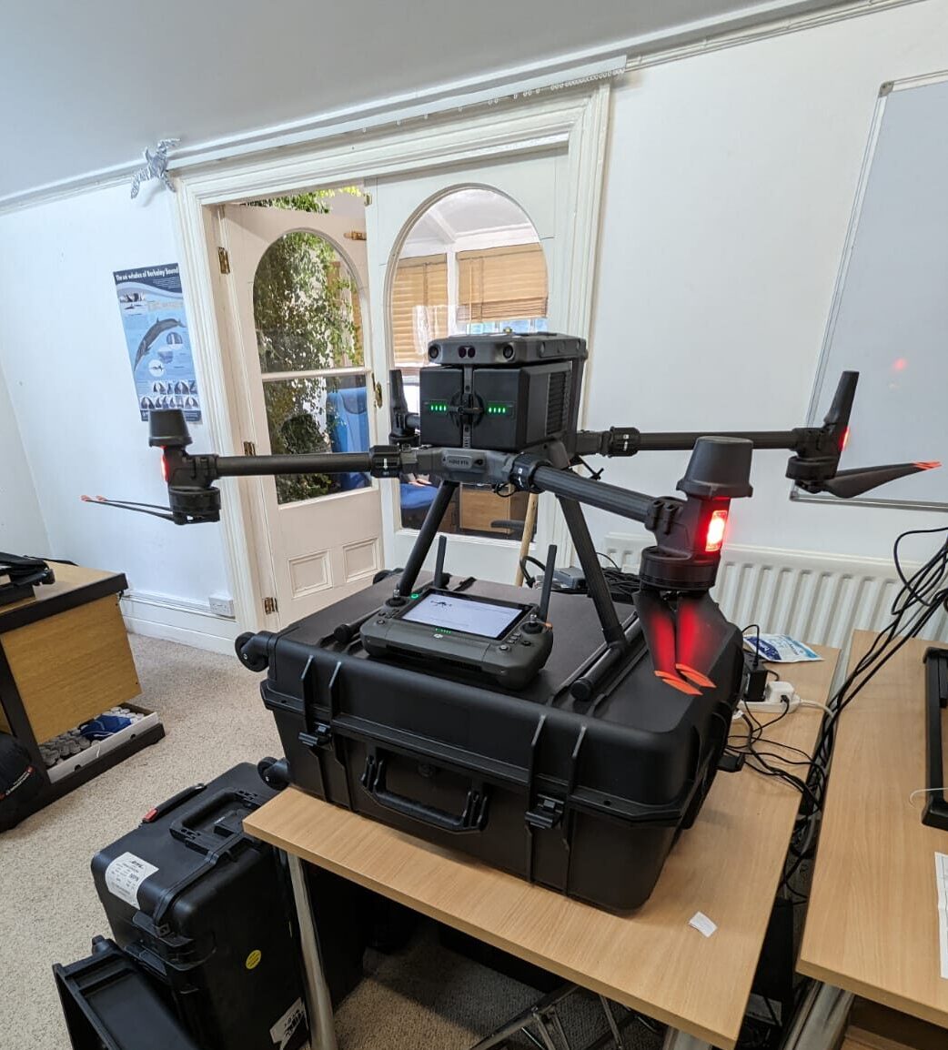
The objective of the project is to increase the ability of SAERI to undertake on the ground research to feed into policy and decision-making in the Falkland Islands by purchasing a thermal imaging Unmanned Aerial Vehicle (UAV) i.e. a DJI Matrice 300 RTK UAV with an attachable Zenmuse H20T Thermal Camera.

Recently a thermal UAV was present for a short time on the island, it had been brought to the Falkland Islands by an academic for specific seabird research, and SAERI was able to undertake some short flights with the UAV. When the imagery from the drone flights was captured and demonstrated to colleagues in the Falkland Islands Government, there was lots of enthusiasm and interest in the possibilities for capturing and using thermal imagery. Some of the ideas generated are outlined below:

Agriculture: Farmers and agricultural assistants can use thermal imaging UAVs to monitor crop health, identify areas of irrigation issues, detect pest infestations, and assess overall plant stress. The thermal data can provide valuable insights for optimising irrigation, identifying diseased areas, or assessing the effectiveness of fertilisers.
Energy Auditing: Thermal imaging UAVs can assist in energy auditing for buildings and industrial facilities. They can detect heat loss, identify insulation gaps, or locate energy inefficiencies in heating, ventilation, and air conditioning (HVAC) systems. This information can help improve energy efficiency and reduce operational costs.
Wildlife Monitoring: Thermal imaging UAVs are useful for tracking and monitoring wildlife populations. They can help identify animal movements, track migration patterns, and locate animals in dense vegetation. This information aids in wildlife research, conservation efforts, and tourism activities.
Environmental Surveys: Thermal imaging UAVs can assess environmental conditions, such as water temperatures, thermal anomalies in bodies of water, or the thermal impact of industrial activities on the environment. This data can aid in environmental monitoring and ecosystem management.
Oil Spill Detection: Thermal cameras mounted on UAVs can detect temperature variations caused by oil spills. Oil has a different thermal signature than water, and thermal imaging can help identify and delineate the extent of the spill, especially in low-visibility conditions or at night when the temperature contrast is more pronounced.

It is not envisaged that these activities will happen during the lifespan of the Darwin Plus local project, but the purchase of the thermal imaging UAV will make an important contribution to the long term ability of SAERI and FIG to address the areas identified above, and an action plan for post project implementation will be developed.

Overall, success will be demonstrated in the longer term by the implementation of the ideas above such as improved agricultural practices, enhanced energy efficiency, better wildlife management, effective environmental monitoring, and timely response to oil spill incidents.

Project Team

TARA PELEMBE

JACK INGLEDEW-GALE

PROJECT FUNDING AND PARTNERS:

This project is funded by the UK Government through Darwin Plus Local (project DPL00047

FALKLAND ISLANDS OFFICE:
PO Box 609, Stanley Cottage North
Ross Road, Falkland Islands
Stanley, FIQQ 1ZZ
Falkland Islands: +500 27374
UK Office: +44 (0)20 3745 1731
© Copyright 2022 - SAERI
Proudly designed with Oxygen, the world's best visual website design software
envelopephone-handsetmap-markercheckmark-circle linkedin facebook pinterest youtube rss twitter instagram facebook-blank rss-blank linkedin-blank pinterest youtube twitter instagram