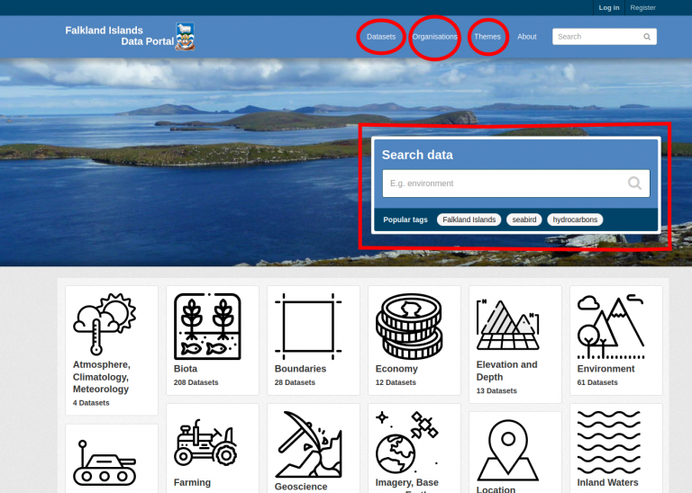
The EDS centre adopted the International standard 19115 which describes all aspects of geospatial metadata and provides a comprehensive set of metadata elements that are widely used as the basis for geospatial metadata services. In order to make the data documentation a fairly straightforward process, the ISO 19115 was kept very simple and essentially only the compulsory aspects of the forms were retained. The metadata form is an excel file which contains an explanation on how to fill each element requested by the form. The file has been reviewed recently as the EDS centre, moved from a very simple tool for discovering metadata (an online metadata search) to a proper Data Portal where the users not only can discover the metadata searching by keywords, themes (metadata topic categories) and organisations, but also access directly to the data (if in the public domain) or request them (if restricted).
The Falkland Islands data portal has adopted the Creative Commons licences and the summary below, sourced from Wikipedia and Creative Commons webpage, wants to provide an easy description of the licences to explain how they fit within the overall concept of open data. Whoever is a data owner is strongly encouraged to think about the type of data licences he/she wants to apply to the data and use the creative common selection tool (https://creativecommons.org/choose/). The legal details on the licences can be found at the Creative Commons webpage.