Winter is at its peak in the Falklands but some SAERI’s projects are based in the places where the summer never ends.
This is the second time the European Marine Observation and Data Network (EMODnet) Seabed Habitats project has been conducted in the Caribbean region, and once again, SAERI is contributing its regional expertise. As the fifth phase of the project nears completion, it is a fitting moment to reflect on and summarise the work accomplished so far.

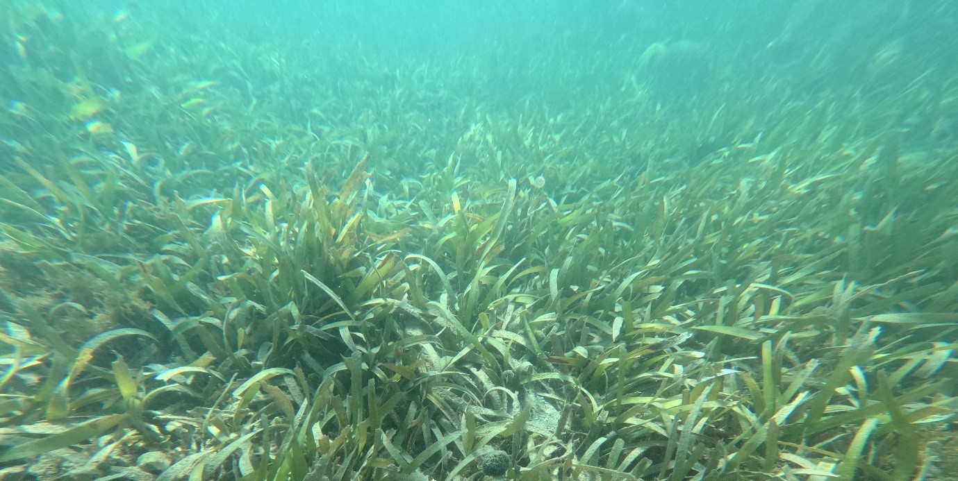
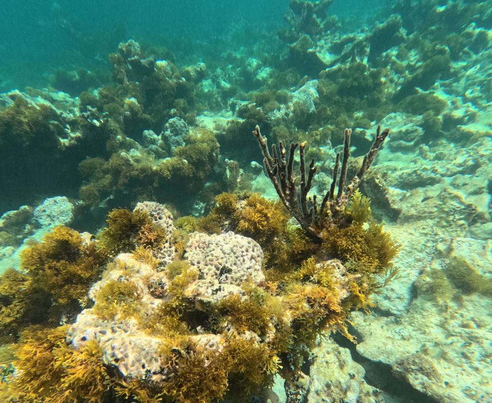
The Caribbean Sea is one of the most biodiverse marine regions in the world, supporting extensive coral reef systems and seagrass meadows that provide essential habitats for a vast array of marine species. At the same time, it is one of the world’s tourist hotspots, which generates high pressure on the marine habitats and environment. To be able effectively manage and protect the unique environments we need to identify and map the seabed habitats in the region, along with important ocean variables and essential fish and marine habitats.
The European Marine Observation and Data Network (EMODnet) is a group of organizations formed by the European Commission Directorate-General for Maritime Affairs and Fisheries in 2009. Today, it has grown to more than 120 organizations and functions as a data initiative that collates, standardizes, and publishes marine datasets as freely available and downloadable products. EMODnet is based on a “collect once, use many times” mindset that allows marine data to be used in policy decisions, climate change adaptations, understanding changes in the environment over time, and stimulating blue growth. The EMODnet Seabed Habitats data theme is composed of maps, datasets, models, and environment variables that provide information on marine benthic habitats and coastal wetlands. One of the partner activities as part of the EMODnet Seabed Habitats project is to collect datasets, standardize them according to a prescribed data exchange format, and write metadata. In some cases, datasets are combined to form composite data products. In the Caribbean the current phase along with data collection focuses on developing standardized benthic habitat classification for the region and expanding the collaboration with stakeholders.
The European Marine Observation and Data Network (EMODnet) is a group of organizations formed by the European Commission Directorate-General for Maritime Affairs and Fisheries in 2009. Today, it has grown to more than 120 organizations and functions as a data initiative that collates, standardizes, and publishes marine datasets as freely available and downloadable products. EMODnet is based on a “collect once, use many times” mindset that allows marine data to be used in policy decisions, climate change adaptations, understanding changes in the environment over time, and stimulating blue growth. The EMODnet Seabed Habitats data theme is composed of maps, datasets, models, and environment variables that provide information on marine benthic habitats and coastal wetlands.

One of the partner activities as part of the EMODnet Seabed Habitats project is to collect datasets, standardize them according to a prescribed data exchange format, and write metadata. In some cases, datasets are combined to form composite data products. In the Caribbean the current phase along with data collection focuses on developing standardized benthic habitat classification for the region and expanding the collaboration with stakeholders.
To achieve that Marcin Gorny, the project manager and marine specialist came to the Anguilla Department of Natural Resources in March this year. Marcin has been working with the Department staff to understand the local perspective and identify all the habitat work, including surveys and mapping efforts in and around Anguilla. He collected several new datasets for Anguilla and established the connection with stakeholders on the neighboring island of Saint Martin. In addition, new datasets for wider Caribbean Region were also identified including new high-resolution mangrove data, seagrass maps for Bahamas and benthic habitat maps for Dutch Caribbean to name just a few. Last but not least, he is working on the review of benthic habitat projects and classifications in the region which will be a background for developing region-specific EMODnet classification schema. Together with SAERI’s CEO Paul Brickle who is visiting the island in early July they will be also looking for opportunities to enhance work of the SAERI’s sister institute, MAERI and explore the opportunities for research in the region.
Additionally, Marcin has been also exploring some of the most iconic Caribbean habitats of Anguilla including Little Harbor mangrove sites and coral reefs of the northern side of the island.

