This quarter brought together fieldwork, digital capacity building and behind-the-scenes system improvements across SAERI’s projects in the Falkland Islands. Highlights included post-fire monitoring on Sea Lion Island, GIS training for FIG staff and continued work to update and maintain key datasets on the Falkland Islands Data Portal.
Post-Fire Monitoring on Sea Lion Island
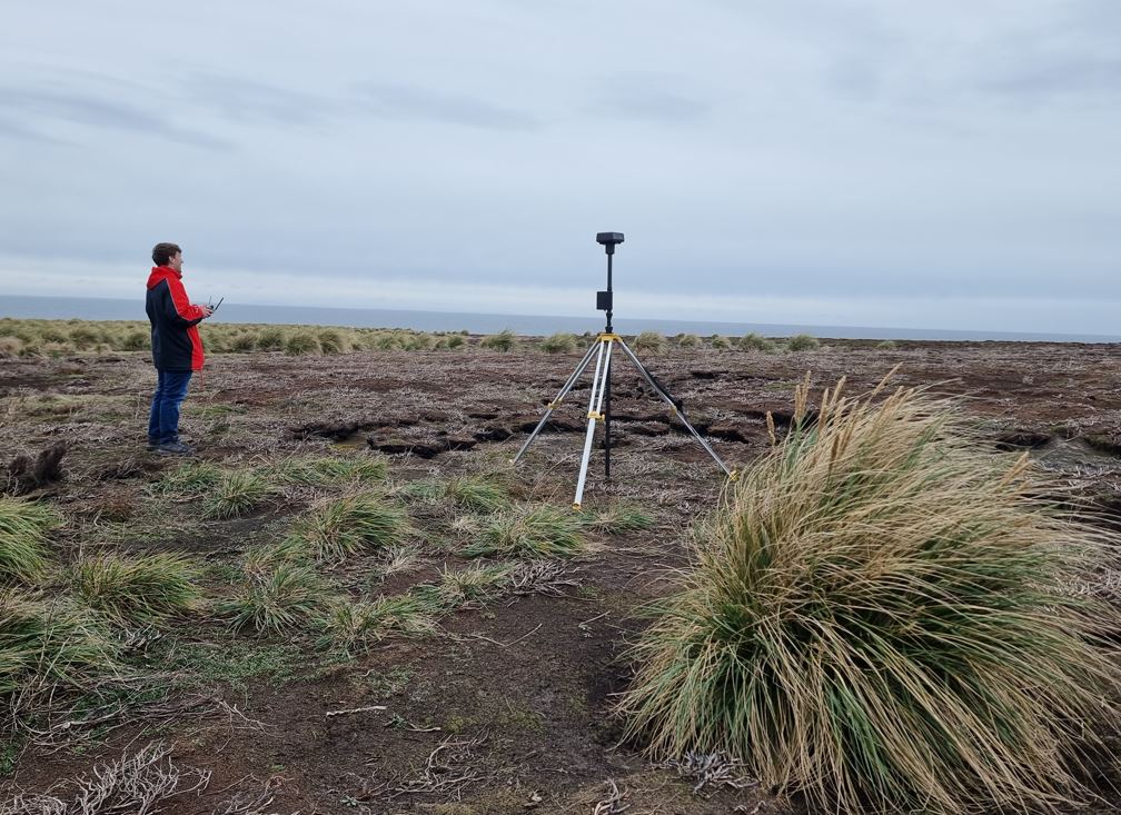
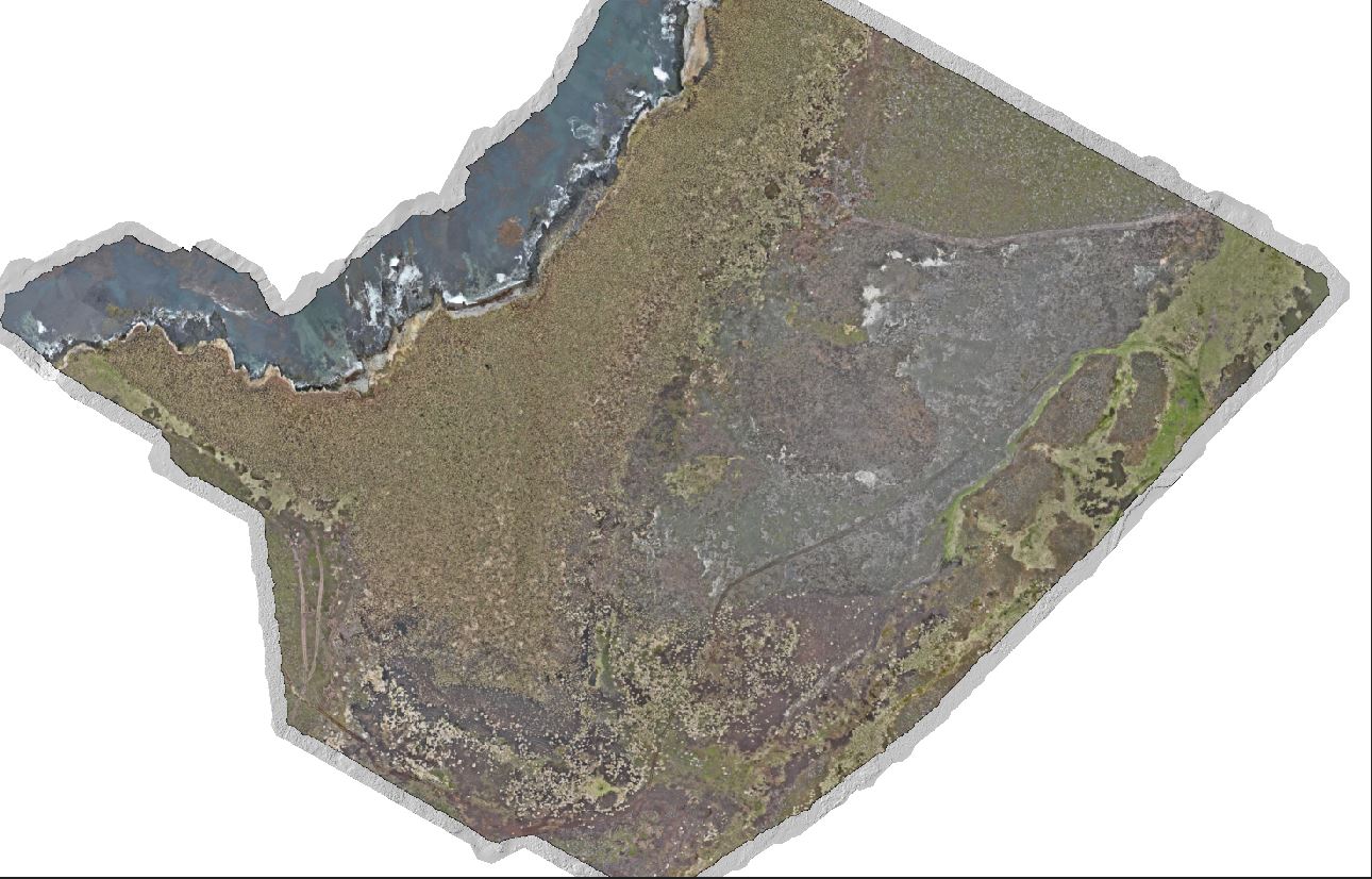
In October, Evan Langridge and I travelled to Sea Lion Island to support post-fire restoration monitoring efforts, as highlighted on SAERI’s LinkedIn. Using the DJI Matrice 350 equipped with the Zenmuse L2 LiDAR scanner, we collected high-resolution imagery and detailed point-cloud data across the 2024 burn area.
The resulting dataset will enable precise monitoring of vegetation regrowth and soil erosion. This will provide a strong evidence base for future restoration planning. It was great to be back in the field and to see technology directly contributing to long-term environmental management.
Strengthening Local GIS Capacity
Back in Stanley, I delivered basic GIS training for staff in the FIG Environment Department. The session focused on building confidence in using spatial data for everyday tasks, including the use of key plugins, creating new data layers, attributing features and editing existing datasets. Strengthening these foundational skills remains a priority and helps ensure spatial information is used effectively across government.
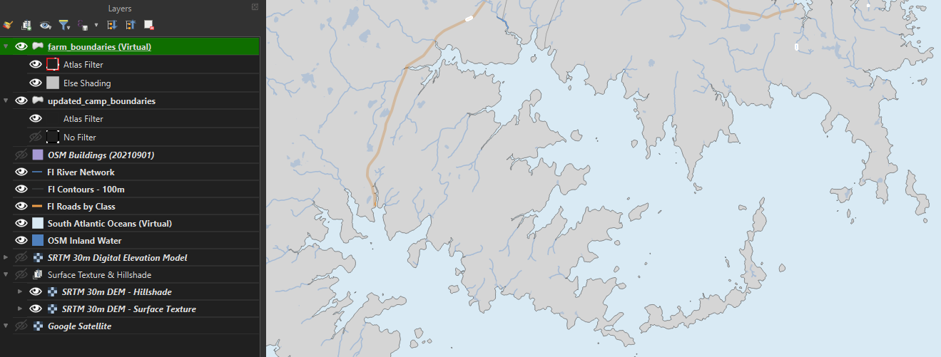
Improving Data Infrastructure and Maintenance
Behind the scenes, a significant amount of time has gone into ensuring SAERI’s digital systems continue to run smoothly. This included clearing space on our PostgreSQL server, updating AIS and weather station datasets for the Falkland Islands Data Portal following expansion of the FIG network, and assessing how best to maintain the portal within a changing network environment.
Keeping datasets clean, consistent and up to date is essential for reliability, especially as more users and partners depend on these platforms. It is also a very time-consuming part of the work.
Practical Mapping for the Farming Community
I have also been working with the FIG Agricultural Department to produce Avenza-friendly GeoPDF maps tailored to individual farm holdings. These maps allow farmers to navigate, capture field data and remap fences and boundaries while out on the land. It is a practical demonstration of how spatial data can directly support day-to-day decisions across the Islands.
Automating Administration and File Management
To improve internal efficiency, I have been developing a series of Python scripts to automate routine administration tasks and streamline file management workflows. These tools are already reducing manual handling and freeing up time for analysis, training and wider project delivery.
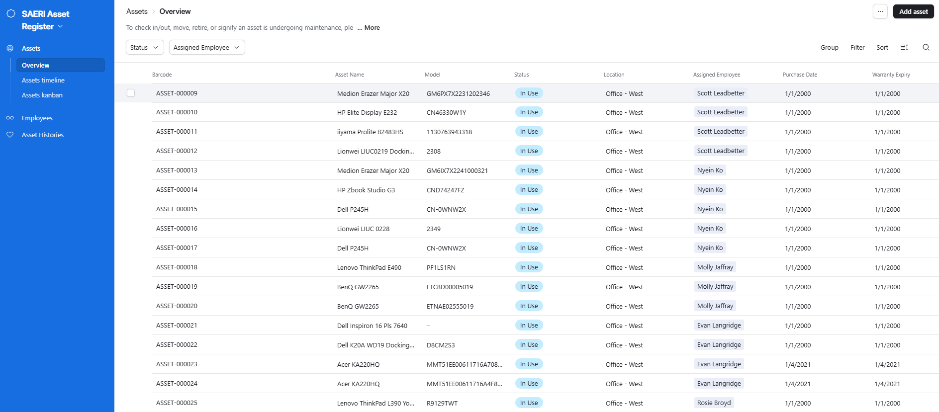
Supporting Asset Management Systems
Following my development of SAERI’s bespoke asset register, I have been training colleagues in its use and leading the initial population of desk-based equipment. This work is laying the foundation for a complete organisational asset inventory and will help ensure future auditing, equipment replacement and tracking are undertaken efficiently.